Last Updated on
By Luke Brandenburg
Before you head into any territory that you aren’t completely familiar with, you should always prepare for the worst case scenario. When the conditions suddenly change, navigation can become very difficult without a handheld GPS device. Washed-out and poorly-marked trails may lead you off the path where you will have to fend for yourself.
While it is always a good idea to bring a map and compass for backup, a fully-charged GPS device can go a long ways towards getting you back to safety. Finding the right GPS device for you can be a challenge in itself. Here’s a few basics on how to select a GPS:
Handheld GPS Devices vs. Smartphone Apps
Smartphones go everywhere we go these days. So why should you carry a handheld GPS device when you smartphone already has GPS applications?
Battery Life
Everyone knows how much of a pain it can be when your phone dies, and you have no convenient way to charge it. That feeling would be much worse if you were depending on your smartphone to save your life in that scenario.
This is the biggest problem with any electronic device as an outdoorsmen’s safety tool. However, a handheld GPS typically runs for much longer than a smartphone on one battery charge, and most use simple AA batteries that can be taken along as extras. Lithium batteries also offer longer life for long trek’s out into the wilderness.
Durability
The other major downfall of smartphones in any scenario is their durability. One quick dunk into a stream, a hard rain storm, or a fumble onto a rock could ruin your chances of navigating to safety with your smartphone. Handheld GPS devices are designed to withstand the elements in the backcountry.
Coverage
If you’ve ever taken your phone into a sparsely-populated area, you know that it can be quite useless without coverage. GPS devices don’t require a phone provider’s coverage. All you need to use a GPS unit is a view of the sky. Some of them even perform well under dense tree cover.
Features
There are also some very helpful features you can get with your GPS device that your smartphone can’t provide. For example, a barometer feature can help you keep track of changing weather conditions, an electronic compass feature can provide accurate directions and an altimeter feature can show you where you stand on a vertical plane. Most GPS devices also allow you to exchange information with another computer such as coordinates, routes, geocaches and more.
The mapping features of GPS devices also make them superior to smartphones in the backcountry. They don’t require data connections to download maps, and most will support an array of map options from topographic to waterway mapping.
Basic Functions of a GPS Device
Almost all handheld GPS devices include four basic functions:
Positional Display
All GPS receivers, in their most basic form, show your present coordinates. Most will also display your location in relation to previously programmed waypoints. Mapping-capable devices give you your location on a digital map.
Track-Logging
A basic GPS receiver can record your locations as you travel. Think of it like leaving behind a trail of bread crumbs in the digital world. Those who want to keep a record of a certain hunt, ride, hike or run can see their exact path throughout the trek. This feature also allows you to retrace your own footsteps in case you need to turn around.
P2P Navigation
P2P, or point-to-point, navigation is a common feature that helps to guide you directly to a given waypoint or destination. Most devices display a precise direction and distance to the target coordinates.
Planned Route Navigation
Taking it a step farther than P2P navigation, planned route navigation allows you to input a string of different waypoints. This gives you planned navigational route for a long hike or journey with multiple stopping points.
The Accuracy of GPS
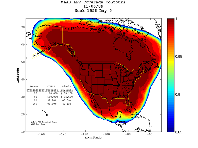
Generally, a normal GPS unit is accurate within approximately 30 feet. A GPS device that is “WAAS-enabled” can offer even better accuracy. WAAS stands for the Wide Area Augmentation System and allows GPS devices to pinpoint coordinates within 10 feet under ideal conditions.
The WAAS network consists of an array of ground-based stations in North America that work with a series satellites to improve GPS accuracy. If these satellites are out of view from your current location, WAAS will not work.
Common GPS Feature Comparisons
Although all handheld GPS devices support the basic functions of navigation, many offer added features to improve their usability and performance. These features all have pros and cons. You just need to decide which ones make sense for you.
Interfaces
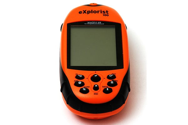
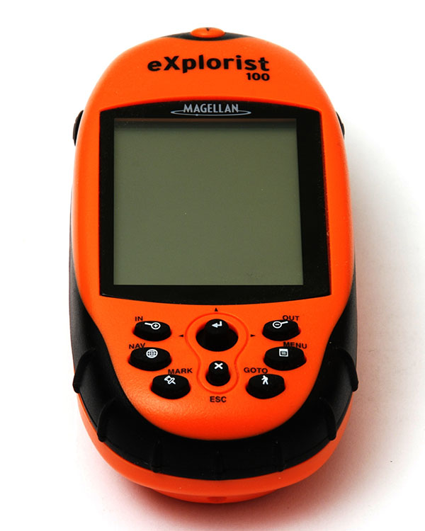
Some GPS devices come with familiar touch-screens that give the user an intuitive and customizable interface. There are some advantages to the traditional push-button interfaces as well. Push-button devices are more practical for use with gloves and biking applications, and most have clearly-labeled function keys.
Color Screens
When trying to navigate on a map or read detailed data, color displays are very helpful. Map navigation near water can be especially difficult with a black and white screen. However, color comes with an added cost.
Electronic Compasses
If you’re standing still, a basic GPS device has no idea which direction you’re facing. It can only find direction when you are actually moving. A GPS with an electronic compass, however, can easily provide this information without movement.
Electronic compasses must be calibrated before use, and you should never count on them over your floating-needle compass as a survival tool. Electronic compasses will also drain your GPS devices batteries more quickly when enabled.
Barometers/Altimeters
When you need a solid estimate of your elevation and don’t have good satellite reception, a GPS device with a barometric altimeter can be a great tool. The barometer is also very helpful for tracking changes in the weather.
While the barometric altimeter can be an effective tool, they must be calibrated often and many take some practice and skill to use correctly. Barometers also need to be relatively stationary to provide good weather data.
Memory
Memory on a GPS works much like memory on a digital camera. It is either stored internally or onto a microSD card. GPS devices use this memory to store waypoints, routes and map data. Some units even store pictures, audio and video.
Mapping Software Support
Although many GPS devices do support different kinds of mapping software, some do not. The basic map feature provided by most GPS devices is extremely limited, so it is important to select a GPS unit that supports your mapping software needs. Some devices also come with pre-loaded mapping software so you don’t have the added cost of purchasing the software separately.
There are many other great features found on GPS devices. The key is to figure out which ones you need for what you like to do. A backcountry hunter needs a different GPS device than a mountain biker. No matter what type you choose, you will be making the smart decision to ensure your safety out in the field.
